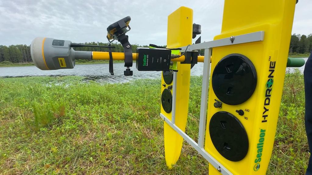
Pasco County surveyors have adopted a new remote-controlled underwater drone called a hydrone to map submerged landscapes more efficiently. This lightweight unmanned surface vehicle uses real-time sonar and GPS data to collect detailed information about lake and river bottoms. Alex Parnes, the county surveyor, explains that the technology allows teams to quickly create three-dimensional maps of water bodies previously requiring days of work. The device is particularly useful for assessing water depth for storm management and examining bridge foundations before construction projects begin. Survey technician Jack Laporte notes that tasks once taking three days can now be completed in half a day with this advanced equipment. While the technology reduces manual labor, human surveyors remain essential to interpret data and integrate findings into official land records. The county has already utilized the hydrone on several bridge projects and plans to acquire additional units soon.
Pasco County Surveyors Use New Underwater Drone Technology for Efficient Mapping